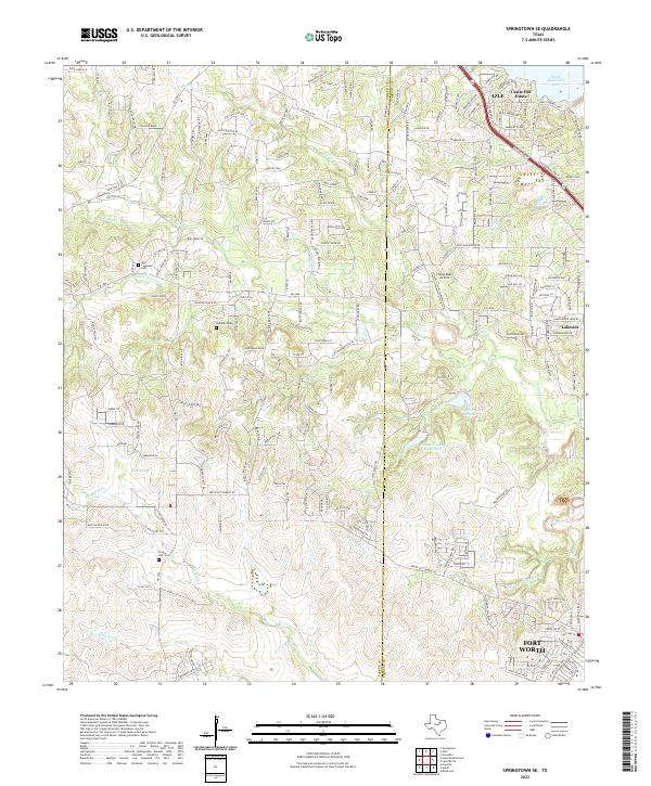
2022 Map of Springtown SE
USGS Topo · Published 2022About this map
Azle and the surrounding Parker and Tarrant County borderlands are characterized by a network of dendritic creeks and expanding residential developments. The landscape is defined by its watercourses, including Mill Creek, Silver Creek, and Marys Creek, which drain toward the eastern edge of the quadrangle. Significant for genealogical research are the local burial sites like Murr - Copeland Cem and Newsom Cem, which anchor the map with ancestral ties to the early settlement of this region. The expansion of Fort Worth is visible in the lower right corner, while the northeastern corner reaches the shoreline of Eagle Mountain Lake. This area maintains its rural-suburban character with features like the Flying Oaks Airport and isolated terrain markers such as Calhoun Bend and Stacey Valley.
Find a feature on this map
205 named features on this map. Tap any name to fly to it.
Don’t see what you’re looking for? This feature index may not catch every label — zoom into the map to look around manually.
Map Details
Editions of this 2022 Springtown SE Map
This is the sole edition of this map. No revisions or reprints were ever made.
Other maps of this area

1891 · Weatherford
USGS Topo · 1:125,000

1893 · Weatherford
USGS Topo · 1:125,000

1894 · Fort Worth
USGS Topo · 1:125,000

1932 · Springtown
USGS Topo · 1:62,500

1954 · Dallas
USGS Topo · 1:250,000

1955 · Avondale
USGS Topo · 1:24,000

1955 · Aledo
USGS Topo · 1:24,000

1955 · Azle
USGS Topo · 1:24,000

1955 · Lake Worth
USGS Topo · 1:24,000

1955 · Benbrook
USGS Topo · 1:24,000