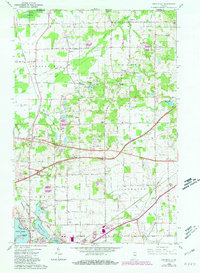
1958 Map of Springville
USGS Topo · Published 1981About this map
The Galena River and its surrounding wetlands, including Crosby Marsh, dominate the northern portion of this northern Indiana landscape during the mid-to-late twentieth century. The map illustrates a region in transition as modern infrastructure like the Indiana Toll Road cuts through rural townships such as Springfield, Galena, and Kankakee. Transportation is a central theme, with the corridor heavily influenced by the Chicago South Shore and South Bend, the Norfolk and Western, and the Chesapeake and Ohio railroads. Small community centers like Hesston, Springville, and Byron are preserved alongside essential local landmarks including the Fish Hatchery and Posey Chapel. On the outskirts of La Porte, recreational and residential features such as the Drive-in Theater, several trailer parks, and the waters of Fishtrap Lake and Tee Lake reflect the area's mid-century development and land use patterns.
Find a feature on this map
38 named features on this map. Tap any name to fly to it.
Don’t see what you’re looking for? This feature index may not catch every label — zoom into the map to look around manually.
Map Details
Editions of this 1958 Springville Map
2 editions found
Other maps of this area

1930 · Three Oaks
USGS Topo · 1:62,500

1944 · Three Oaks
USGS Topo · 1:62,500

1953 · Chicago
USGS Topo · 1:250,000

1957 · Chicago
USGS Topo · 1:250,000

1958 · Stillwell
USGS Topo · 1:24,000

1958 · Michigan City East
USGS Topo · 1:24,000

1958 · La Porte East
USGS Topo · 1:24,000

1958 · Springville
USGS Topo · 1:24,000

1958 · New Carlisle
USGS Topo · 1:24,000
1961 · La Porte West
USGS Topo · 1:24,000