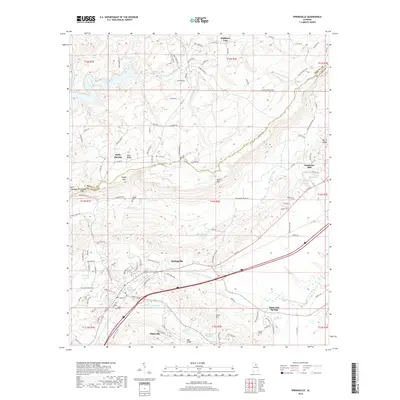
2018 Map of Springville
USGS Topo · Published 2018About this map
Springville and Odenville anchor this 2018 survey of St. Clair County, Alabama, where the transition between ridge-and-valley topography and settled lowlands is sharply defined. The terrain is dominated by prominent elevations such as Blount Mtn and Jones Mtn, while the valleys are drained by the Big Canoe Cr and the Blackburn Fork Little Warrior River. This landscape is punctuated by numerous small bodies of water, including Canoe Lake, Hickman Lake, and Mountain View Lake, reflecting the region's complex local hydrology.
Find a feature on this map
126 named features on this map. Tap any name to fly to it.
Don’t see what you’re looking for? This feature index may not catch every label — zoom into the map to look around manually.
Map Details
Editions of this 2018 Springville Map
This is the sole edition of this map. No revisions or reprints were ever made.
Other maps of this area

1889 · Springville
USGS Topo · 1:125,000

1889 · Birmingham
USGS Topo · 1:125,000

1892 · Birmingham
USGS Topo · 1:125,000

1892 · Springville
USGS Topo · 1:125,000

1895 · Birmingham
USGS Topo · 1:125,000

1905 · Leeds
USGS Topo · 1:62,500

1907 · Birmingham
USGS Topo · 1:125,000

1907 · Leeds
USGS Topo · 1:62,500

1953 · Birmingham
USGS Topo · 1:250,000

1956 · Birmingham
USGS Topo · 1:250,000