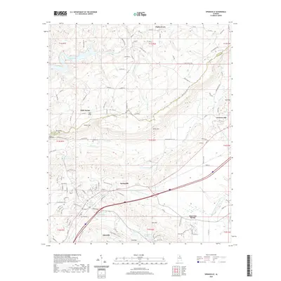
2020 Map of Springville
USGS Topo · Published 2020About this map
Springville and Saint Clair Springs anchor this landscape where the ridges of the Appalachians descend into central Alabama. The terrain is defined by a series of prominent elevations including Blount Mtn, Jones Mtn, and Saint Clair Mtn, which create natural corridors for water and transport. Hydrological features are abundant, from the sprawling Inland Lake in the northwest to the localized Herrings Big Spring and Hickman Lake near Odenville.
Find a feature on this map
110 named features on this map. Tap any name to fly to it.
Don’t see what you’re looking for? This feature index may not catch every label — zoom into the map to look around manually.
Map Details
Editions of this 2020 Springville Map
This is the sole edition of this map. No revisions or reprints were ever made.
Other maps of this area

1889 · Springville
USGS Topo · 1:125,000

1889 · Birmingham
USGS Topo · 1:125,000

1892 · Birmingham
USGS Topo · 1:125,000

1892 · Springville
USGS Topo · 1:125,000

1895 · Birmingham
USGS Topo · 1:125,000

1905 · Leeds
USGS Topo · 1:62,500

1907 · Birmingham
USGS Topo · 1:125,000

1907 · Leeds
USGS Topo · 1:62,500

1953 · Birmingham
USGS Topo · 1:250,000

1956 · Birmingham
USGS Topo · 1:250,000