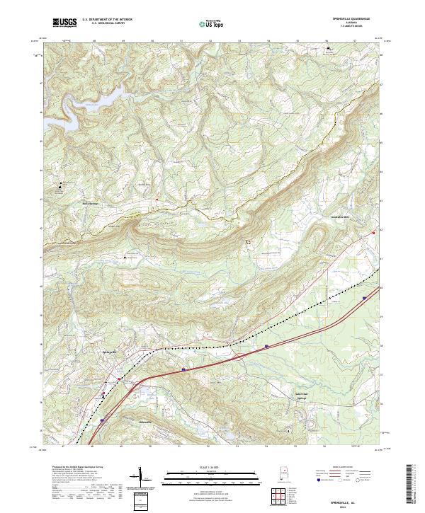
2024 Map of Springville
USGS Topo · Published 2024About this map
Blount Mountain dominates the central topography of this Alabama landscape, dividing the drainage of the Blackburn Fork Little Warrior River to the northwest from the valleys of Big Canoe Creek to the southeast. The area around Springville and Odenville shows a modern pattern of transit and settlement, anchored by Interstate 59 and US Highway 11, which follow the natural corridor of the valley floor. Historical landmarks are abundant throughout the region, including several family burial grounds such as the Hooper Cem and Mardis Cem, alongside local hubs like Smiths Ferry and Goodwins Mill.
Find a feature on this map
133 named features on this map. Tap any name to fly to it.
Don’t see what you’re looking for? This feature index may not catch every label — zoom into the map to look around manually.
Map Details
Editions of this 2024 Springville Map
This is the sole edition of this map. No revisions or reprints were ever made.
Other maps of this area

1889 · Springville
USGS Topo · 1:125,000

1889 · Birmingham
USGS Topo · 1:125,000

1892 · Birmingham
USGS Topo · 1:125,000

1892 · Springville
USGS Topo · 1:125,000

1895 · Birmingham
USGS Topo · 1:125,000

1905 · Leeds
USGS Topo · 1:62,500

1907 · Birmingham
USGS Topo · 1:125,000

1907 · Leeds
USGS Topo · 1:62,500

1953 · Birmingham
USGS Topo · 1:250,000

1956 · Birmingham
USGS Topo · 1:250,000