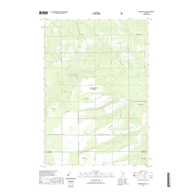
2019 Map of Sprinkler Lake
USGS Topo · Published 2019About this map
Huron National Forest dominates this section of Alcona and Iosco Counties, where a complex network of tributaries feeds into the Pine River system. The landscape is defined by the convergence of several major branches, including the S Br Pine River and the W Br Pine River, which cut through the timberland alongside smaller drainages like McGillis Cr and Gimlet Creek. This 2019 survey documents a terrain heavily partitioned by administrative forestry and wildlife management boundaries, such as the Alcona SMT Turkey FT DNR962 area.
Find a feature on this map
47 named features on this map. Tap any name to fly to it.
Don’t see what you’re looking for? This feature index may not catch every label — zoom into the map to look around manually.
Map Details
Editions of this 2019 Sprinkler Lake Map
This is the sole edition of this map. No revisions or reprints were ever made.
Other maps of this area

1954 · Tawas City
USGS Topo · 1:250,000

1958 · Tawas City
USGS Topo · 1:250,000

1959 · Tawas City
USGS Topo · 1:62,500

1959 · East Tawas
USGS Topo · 1:62,500

1959 · Glennie
USGS Topo · 1:62,500

1959 · Harrisville
USGS Topo · 1:62,500

1983 · Hubbard Lake
USGS Topo · 1:100,000

1984 · Tawas City
USGS Topo · 1:100,000
1989 · Barton City
USGS Topo · 1:24,000

1989 · Mikado
USGS Topo · 1:24,000