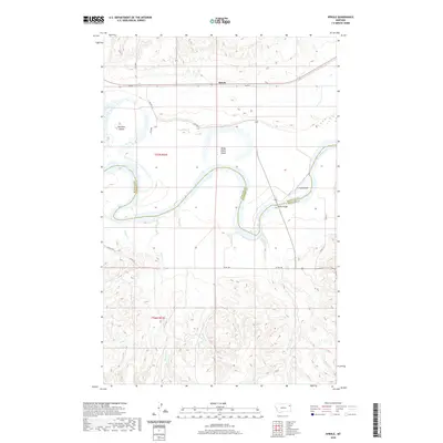
2020 Map of Sprole
USGS Topo · Published 2020About this map
The Missouri River carves a complex, meandering path through this high-plains landscape, defining the jagged border between Roosevelt County and Richland County. The small settlement of Sprole sits along a straight corridor of transportation north of the river, where BIA Rte 1 and its associated road network provide access to the surrounding plateaus. The river itself is dominated by significant landforms such as White Shield Island and Skinners Island, while Poplar Bridge serves as a critical crossing point over the active waterway. Numerous drainages, including Colgan Creek, First Creek, and Bilger Creek, cut through the southern badlands, illustrating a highly eroded topography that drains northward toward the main Missouri channel. This survey documents the intersection of tribal land management and county boundaries in a region where the river's historical shifts have created a complex patchwork of island features like Ivys Island.
Find a feature on this map
25 named features on this map. Tap any name to fly to it.
Don’t see what you’re looking for? This feature index may not catch every label — zoom into the map to look around manually.
Map Details
Editions of this 2020 Sprole Map
This is the sole edition of this map. No revisions or reprints were ever made.
Other maps of this area

1909 · Glendive
USGS Topo · 1:250,000

1912 · Poplar
USGS Topo · 1:62,500

1914 · Brockton
USGS Topo · 1:62,500

1954 · Glendive
USGS Topo · 1:250,000

1954 · Wolf Point
USGS Topo · 1:250,000

1957 · Glendive
USGS Topo · 1:250,000

1958 · Wolf Point
USGS Topo · 1:250,000

1958 · Glendive
USGS Topo · 1:250,000

1972 · Poplar
USGS Topo · 1:24,000

1972 · Poplar NE
USGS Topo · 1:24,000