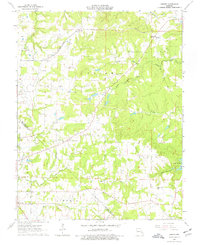
1964 Map of Sprott
USGS Topo · Published 1977About this map
The Missouri-Illinois railroad corridor cuts across the rugged drainage divide between Ste Genevieve and St Francois counties in this mid-1960s landscape. Small rural communities like Sprott and Millers anchor the upland plateaus, supported by institutions such as Genevieve Ch and the Pleasant Hill Ch. The map reveals a dense network of family-named landmarks and infrastructure from an earlier era of rural settlement, including the Chestnut Ridge Sch and Busiek Sch.
Find a feature on this map
30 named features on this map. Tap any name to fly to it.
Don’t see what you’re looking for? This feature index may not catch every label — zoom into the map to look around manually.
Map Details
Editions of this 1964 Sprott Map
2 editions found
Other maps of this area

1904 · Farmington
USGS Topo · 1:62,500

1906 · Farmington
USGS Topo · 1:62,500

1907 · Weingarten
USGS Topo · 1:62,500

1909 · Weingarten
USGS Topo · 1:62,500

1910 · Higdon
USGS Topo · 1:62,500

1939 · Fredericktown
USGS Topo · 1:48,000

1947 · Fredericktown
USGS Topo · 1:62,500

1949 · Rolla
USGS Topo · 1:250,000

1950 · Fredericktown
USGS Topo · 1:62,500

1953 · Rolla
USGS Topo · 1:250,000