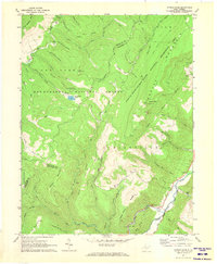
1970 Map of Spruce Knob
USGS Topo · Published 1973About this map
Spruce Mountain dominates this portion of the Allegheny Highlands, reaching its apex at Spruce Knob, the highest point in West Virginia. This 1970 survey illustrates a landscape primarily defined by the Monongahela National Forest and the Spruce Knob-Seneca Rocks National Recreation Area. The settlement of Cherry Grove sits along the South Branch Potomac River, serving as a focal point for the small mountain community. Topographic details reveal the complex drainage systems of Seneca Creek and Gandy Creek, which carve deep valleys like Switchback Hollow and Late Hedrick Hollow. Genealogists and local historians can find family-named landmarks such as Lee Bennett Hol and Grants Branch, alongside community anchors like Big Run Chapel and several mountain cemeteries. The inclusion of Old Railroad Run points to a history of timber extraction that shaped these high ridges before they became protected recreational lands.
Find a feature on this map
50 named features on this map. Tap any name to fly to it.
Don’t see what you’re looking for? This feature index may not catch every label — zoom into the map to look around manually.
Map Details
Editions of this 1970 Spruce Knob Map
This is the sole edition of this map. No revisions or reprints were ever made.
Other maps of this area

1889 · Beverly
USGS Topo · 1:125,000

1892 · Beverly
USGS Topo · 1:125,000

1892 · Franklin
USGS Topo · 1:125,000

1896 · Franklin
USGS Topo · 1:125,000

1920 · Onego
USGS Topo · 1:62,500

1921 · Onego
USGS Topo · 1:48,000

1922 · Onego
USGS Topo · 1:62,500

1922 · Horton
USGS Topo · 1:48,000

1922 · Spruce Knob
USGS Topo · 1:48,000

1922 · Circleville
USGS Topo · 1:62,500