
1953 Map of Spruce Mountain
USGS Topo · Published 1955About this map
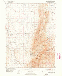
Spruce Mountain dominates the center of this Elko County survey, surrounded by the high desert basins of Clover Valley and Independence Valley. The mid-century map documents an intensive mining landscape concentrated on the southern slopes of the ridge, where a cluster of operations including the Black Forest Mine, Monarch Mine, and Standard Mine are linked by a network of steep trails and a pipe line. At the foot of these workings, the settlement of Sprucemont is noted as a site, suggesting the transition from a populated mining camp to a relic of the area's mineral booms. The surrounding landscape is defined by the vital locations of water sources like Latham Spring and Basco Spring, while labels like Shearing Corral and Sheep Camp reflect the livestock grazing economy that persisted alongside the extraction of silver and lead ores from the mountain's limestone.
Find a feature on this map
29 named features on this map. Tap any name to fly to it.
Don’t see what you’re looking for? This feature index may not catch every label — zoom into the map to look around manually.
Map Details
Editions of this 1953 Spruce Mountain Map
4 editions found
Other maps of this area

1935 · Halleck
USGS Topo · 1:125,000

1953 · Spruce Mountain 4
USGS Topo · 1:62,500

1955 · Elko
USGS Topo · 1:250,000

1958 · Elko
USGS Topo · 1:250,000

1962 · Elko
USGS Topo · 1:250,000

1965 · Elko
USGS Topo · 1:250,000

1968 · Independence Valley SW
USGS Topo · 1:24,000

1968 · Snow Water Lake
USGS Topo · 1:24,000

1968 · Ventosa
USGS Topo · 1:24,000
1969 · Gordon Creek
USGS Topo · 1:24,000