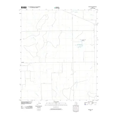
2010 Map of Spur NW
USGS Topo · Published 2010About this map
Red Mud serves as a primary marker in this rural expanse of Dickens County, where the drainage patterns of the Llano Estacado define the landscape. The map reveals an intricate network of waterways, including the winding course of Red Mud Creek and its tributary Little Red Mud Creek, alongside Grapevine Branch and Spring Creek. These natural features are complemented by 20th-century water management infrastructure, most notably the Soil Conservation Service Site 11 Reservoir and its associated Soil Conservation Service Site 11 Dam.
Find a feature on this map
27 named features on this map. Tap any name to fly to it.
Don’t see what you’re looking for? This feature index may not catch every label — zoom into the map to look around manually.
Map Details
Editions of this 2010 Spur NW Map
This is the sole edition of this map. No revisions or reprints were ever made.
Other maps of this area

1954 · Lubbock
USGS Topo · 1:250,000

1961 · Bunker Hill
USGS Topo · 1:24,000

1962 · Twomile Creek
USGS Topo · 1:24,000

1962 · Smith Tank
USGS Topo · 1:24,000

1967 · Dickens South
USGS Topo · 1:24,000

1967 · Spur
USGS Topo · 1:24,000

1967 · Spur NW
USGS Topo · 1:24,000

1968 · Foreman Chapel
USGS Topo · 1:24,000

1968 · Spur SW
USGS Topo · 1:24,000

1968 · White Camp
USGS Topo · 1:24,000