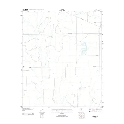
2012 Map of Spur NW
USGS Topo · Published 2012About this map
Red Mud serves as the primary named point of interest in this Dickens County landscape, which is defined by an intricate network of drainage channels that feed into the larger hydrological system of the region. The map reveals a transition from natural creek beds to managed water resources, most notably the Soil Conservation Service Site 11 Reservoir. This topography is deeply etched by the winding paths of Red Mud Cr, Little Red Mud Cr, and Grapevine Br, while Hale Lake and Dockum Cr anchor the northern portion of the quadrangle. The grid of county and ranch roads, including Ranch Road 1081 and Ranch Road 836, provides a structural framework for the expansive ranchlands, highlighting the connectivity of this rural Texas environment.
Find a feature on this map
28 named features on this map. Tap any name to fly to it.
Don’t see what you’re looking for? This feature index may not catch every label — zoom into the map to look around manually.
Map Details
Editions of this 2012 Spur NW Map
This is the sole edition of this map. No revisions or reprints were ever made.
Other maps of this area

1954 · Lubbock
USGS Topo · 1:250,000

1961 · Bunker Hill
USGS Topo · 1:24,000

1962 · Twomile Creek
USGS Topo · 1:24,000

1962 · Smith Tank
USGS Topo · 1:24,000

1967 · Dickens South
USGS Topo · 1:24,000

1967 · Spur
USGS Topo · 1:24,000

1967 · Spur NW
USGS Topo · 1:24,000

1968 · Foreman Chapel
USGS Topo · 1:24,000

1968 · Spur SW
USGS Topo · 1:24,000

1968 · White Camp
USGS Topo · 1:24,000