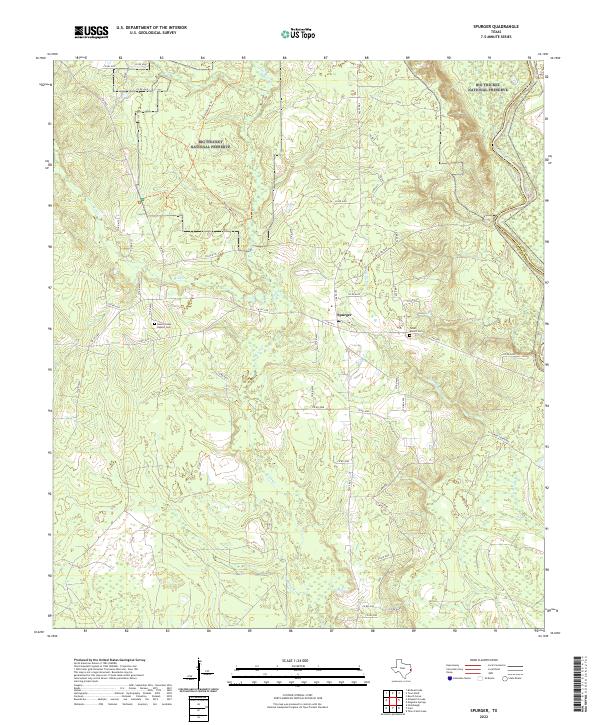
2022 Map of Spurger
USGS Topo · Published 2022About this map
Spurger sits amidst the dense piney woods of East Texas, documented here in a contemporary record of its rural landscape. The community remains a quiet crossroads near the Jasper and Tyler County line, where the local terrain is defined by the slow movement of Little Beech Creek as it winds through the timbered bottomlands. To the east, the Neches River serves as the primary geographic and political boundary, its course shaping the regional transportation and forestry patterns that have long sustained this corner of the state. This survey provides a precise modern reference for the creeks and drainage basins that influence the local ecology within the Big Thicket region.
Find a feature on this map
4 named features on this map. Tap any name to fly to it.
Don’t see what you’re looking for? This feature index may not catch every label — zoom into the map to look around manually.
Map Details
Editions of this 2022 Spurger Map
This is the sole edition of this map. No revisions or reprints were ever made.
Other maps of this area

1954 · Beaumont
USGS Topo · 1:250,000

1955 · Woodville
USGS Topo · 1:62,500

1955 · Curtis
USGS Topo · 1:62,500

1957 · Beaumont
USGS Topo · 1:250,000

1958 · Warren
USGS Topo · 1:62,500

1958 · Spurger
USGS Topo · 1:62,500

1984 · Beaumont
USGS Topo · 1:250,000

1984 · Potato Patch Lake
USGS Topo · 1:24,000
1984 · Beech Grove
USGS Topo · 1:24,000
1984 · Town Bluff
USGS Topo · 1:24,000