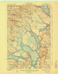
1931 Map of Square Lake
USGS Topo · Published 1931About this map
The interconnected waters of the Fish River chain dominate this northern Maine landscape, where Square Lake and Cross Lake form a central corridor through the timberlands of Aroostook County. Surveyed in the late 1920s, the map reveals a rural economy centered on small-scale milling and remote outposts. The Carriveau Mill stands near the northern edge, supported by a network of district schools including Lincoln Sch, Webster Sch, and Hoover Sch.
Find a feature on this map
76 named features on this map. Tap any name to fly to it.
Don’t see what you’re looking for? This feature index may not catch every label — zoom into the map to look around manually.
Map Details
Editions of this 1931 Square Lake Map
4 editions found
Other maps of this area

1927 · Stockholm
USGS Topo · 1:48,000

1927 · Square Lake
USGS Topo · 1:48,000

1928 · Eagle Lake
USGS Topo · 1:48,000

1928 · Winterville
USGS Topo · 1:48,000

1929 · Portage
USGS Topo · 1:62,500

1929 · Caribou
USGS Topo · 1:48,000

1931 · Square Lake
USGS Topo · 1:62,500

1931 · Eagle Lake
USGS Topo · 1:62,500

1931 · Portage
USGS Topo · 1:62,500

1931 · Stockholm
USGS Topo · 1:62,500