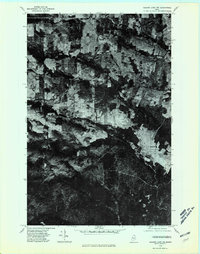
1975 Map of Square Lake NW
USGS Topo · Published 1981About this map
Daigle and Ouellette appear as small, rural settlements amid a patchwork of cleared agricultural land and dense northern forest in the mid-1970s. This orthophotoquad captures the distinct land-use patterns of Northern Maine, where rectangular farm plots and timber tracts define the landscape. Water drainage is represented by the meandering courses of Daigle Brook and Dimock Brook, which cut through the varying topography. The aerial perspective reveals the clear distinction between the cultivated fields along the primary roads and the larger, unbroken forest blocks, reflecting the local reliance on both farming and the timber industry during this era.
Find a feature on this map
4 named features on this map. Tap any name to fly to it.
Don’t see what you’re looking for? This feature index may not catch every label — zoom into the map to look around manually.
Map Details
Editions of this 1975 Square Lake NW Map
This is the sole edition of this map. No revisions or reprints were ever made.
Other maps of this area

1927 · Square Lake
USGS Topo · 1:48,000

1928 · Eagle Lake
USGS Topo · 1:48,000

1931 · Square Lake
USGS Topo · 1:62,500

1931 · Eagle Lake
USGS Topo · 1:62,500

1932 · Frenchville
USGS Topo · 1:48,000

1932 · Fort Kent
USGS Topo · 1:48,000

1935 · Fort Kent
USGS Topo · 1:62,500

1935 · Frenchville
USGS Topo · 1:62,500

1953 · Square Lake
USGS Topo · 1:62,500

1962 · Edmundston
USGS Topo · 1:250,000