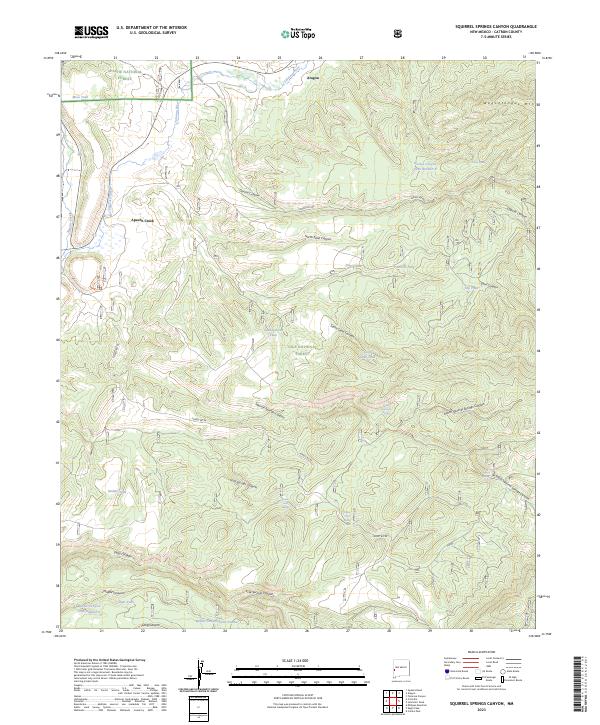
2023 Map of Squirrel Springs Canyon
USGS Topo · Published 2023About this map
Aragon and the smaller settlement of Apache Creek anchor the northern reaches of this New Mexico landscape, situated at the confluence of the Tularosa River and several deep canyon systems. The terrain is defined by its transition between the Apache National Forest and Gila National Forest, featuring the prominent height of Wagontongue Mtn in the northeast. This 2023 survey illustrates a high-desert environment where water management is critical, evidenced by an extensive network of tanks and springs including Sand Canyon Tank, Mesa Tank, and Squirrel Spring. These water sources, combined with primitive roads like Forest Rd 289 and Forest Rd 94, reflect a landscape managed for ranching and forest service operations. The map details a complex drainage system through North Sand Canyon, Cold Springs Canyon, and the primary Squirrel Springs Canyon that carves through the local topography.
Find a feature on this map
42 named features on this map. Tap any name to fly to it.
Don’t see what you’re looking for? This feature index may not catch every label — zoom into the map to look around manually.
Map Details
Editions of this 2023 Squirrel Springs Canyon Map
This is the sole edition of this map. No revisions or reprints were ever made.
Other maps of this area

1915 · Reserve
USGS Topo · 1:125,000

1918 · Pelona
USGS Topo · 1:125,000

1918 · Reserve
USGS Topo · 1:125,000

1954 · Clifton
USGS Topo · 1:250,000

1957 · Clifton
USGS Topo · 1:250,000

1958 · Clifton
USGS Topo · 1:250,000

1962 · Clifton
USGS Topo · 1:250,000
1965 · Milligan Mountain
USGS Topo · 1:24,000
1965 · Aragon
USGS Topo · 1:24,000
1965 · Eagle Peak
USGS Topo · 1:24,000