
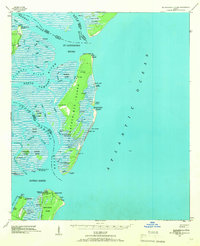
1943 Map of St Catherines Island
USGS Topo · Published 1963About this map
St Catherines Island anchors this coastal Georgia survey, which details a complex network of barrier islands and tidal waterways during the early 1940s. The interior of the island is marked by several Art Well locations and family-named landmarks like Bakers House N Chimney and Kollocks House West Gable. To the south, Sapelo Island and Black Beard Island show evidence of maritime infrastructure, including a Quarantine Flagstaff and a Hospital N Chimney.
Find a feature on this map
50 named features on this map. Tap any name to fly to it.
Don’t see what you’re looking for? This feature index may not catch every label — zoom into the map to look around manually.
Map Details
Editions of this 1943 St Catherines Island Map
2 editions found
Other maps of this area

1920 · Wassaw Sound
USGS Topo · 1:62,500

1920 · Sapelo River
USGS Topo · 1:62,500

1920 · Cabretta Island
USGS Topo · 1:62,500

1920 · Limerick
USGS Topo · 1:62,500

1921 · Darien
USGS Topo · 1:62,500

1928 · St Catherines Island
USGS Topo · 1:62,500

1943 · Sapelo River
USGS Topo · 1:62,500

1944 · Cabretta Island
USGS Topo · 1:62,500

1944 · Limerick
USGS Topo · 1:62,500

1944 · Ossabaw Island
USGS Topo · 1:62,500