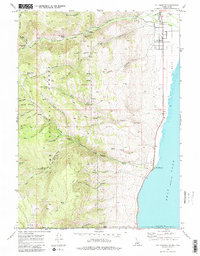
1969 Map of St Charles
USGS Topo · Published 1984About this map
St Charles and Fish Haven anchor this 1969 topographic survey, situated along the western shoreline of Bear Lake. The landscape is defined by the sharp transition from the lake's elevation to the high ridges of the Cache National Forest, where deep drainages like St Charles Canyon and Fish Haven Canyon cut through the terrain. A complex network of travel is visible, ranging from light-duty roads near the shoreline to Pack Trails and Jeep Trails that penetrate the high backcountry.
Find a feature on this map
88 named features on this map. Tap any name to fly to it.
Don’t see what you’re looking for? This feature index may not catch every label — zoom into the map to look around manually.
Map Details
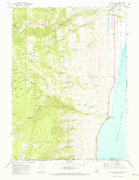
Editions of this 1969 St Charles Map
2 editions found
Other maps of this area

1909 · Montpelier
USGS Topo · 1:125,000

1911 · Montpelier
USGS Topo · 1:125,000

1912 · Randolph
USGS Topo · 1:125,000

1914 · Logan
USGS Topo · 1:125,000

1915 · Preston
USGS Topo · 1:96,000

1916 · Logan
USGS Topo · 1:125,000

1918 · Preston
USGS Topo · 1:125,000

1954 · Ogden
USGS Topo · 1:250,000

1955 · Preston
USGS Topo · 1:250,000

1958 · Ogden
USGS Topo · 1:250,000