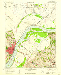
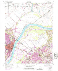
1954 Map of St. Charles
USGS Topo · Published 1959About this map
St Charles is the focal point of this mid-century survey, revealing a riverfront community at the crossroads of established history and emerging infrastructure. On the west bank of the Missouri River, the city layout includes institutional landmarks like Lindenwood College and Sacred Heart Academy, alongside industrial and transportation nodes such as the Wabash railroad line. The landscape transitions into the floodplain of Bryan Island and the marshy expanses of Marais Croche, where several lakes like Graus Lake and the Cul de Sac define the wetlands north of the city. To the east and south, the development of St. Louis County begins to press inward, evidenced by the clustered settlements of Robertson, Bridgeton, and Hazelwood. This era shows a mix of aviation and agriculture, with both the St Charles Airport and Kratz Airport serving the region while peripheral areas like Boschertown and Blase maintain their rural character near the Chicago Burlington And Quincy rail line.
Find a feature on this map
54 named features on this map. Tap any name to fly to it.
Don’t see what you’re looking for? This feature index may not catch every label — zoom into the map to look around manually.
Map Details
Editions of this 1954 St. Charles Map
5 editions found
Other maps of this area

1903 · O'Fallon
USGS Topo · 1:125,000

1924 · Robertson
USGS Topo · 1:24,000

1927 · St. Charles
USGS Topo · 1:62,500

1931 · Brussels
USGS Topo · 1:62,500

1932 · Manchester NE
USGS Topo · 1:24,000

1933 · Creve Coeur
USGS Topo · 1:24,000

1933 · Clayton
USGS Topo · 1:24,000

1933 · Saint Charles
USGS Topo · 1:62,500

1935 · Florissant
USGS Topo · 1:24,000

1939 · Brussels
USGS Topo · 1:62,500