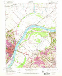
1954 Map of St. Charles
USGS Topo · Published 1969About this map
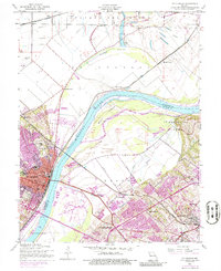
The Missouri River bisects this landscape, separating the urban development of St Charles from the agricultural expanses of St Ferdinand and Portage des Sioux. The mid-century character of St. Charles is evident through its institutional core, featuring Lindenwood College, Sacred Heart Academy, and the Emmaus Home. Significant industrial and transportation infrastructure is present, including the Chicago Burlington and Quincy railroad and the St Charles Airport.
Find a feature on this map
60 named features on this map. Tap any name to fly to it.
Don’t see what you’re looking for? This feature index may not catch every label — zoom into the map to look around manually.
Map Details
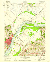
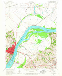
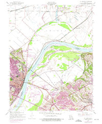
Editions of this 1954 St. Charles Map
5 editions found
Other maps of this area

1903 · O'Fallon
USGS Topo · 1:125,000

1924 · Robertson
USGS Topo · 1:24,000

1927 · St. Charles
USGS Topo · 1:62,500

1931 · Brussels
USGS Topo · 1:62,500

1932 · Manchester NE
USGS Topo · 1:24,000

1933 · Creve Coeur
USGS Topo · 1:24,000

1933 · Clayton
USGS Topo · 1:24,000

1933 · Saint Charles
USGS Topo · 1:62,500

1935 · Florissant
USGS Topo · 1:24,000

1939 · Brussels
USGS Topo · 1:62,500