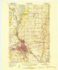
1950 Map of St. Cloud
USGS Topo · Published 1973About this map
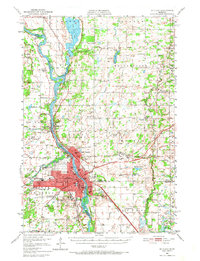
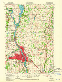
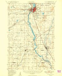
The Mississippi River serves as the central artery for this mid-century survey, dividing the landscape as it flows past the industrial and educational centers of St Cloud and Sauk Rapids. In the southern half, the urban footprint is densely detailed, showcasing the State Teachers College along the riverbanks and the sprawling grounds of the State Reformatory. Local infrastructure is well-defined, from the Municipal Airport to the Veterans Hospital and the prominent St Cloud Hosp.
Find a feature on this map
81 named features on this map. Tap any name to fly to it.
Don’t see what you’re looking for? This feature index may not catch every label — zoom into the map to look around manually.
Map Details
Editions of this 1950 St. Cloud Map
3 editions found
Other maps of this area
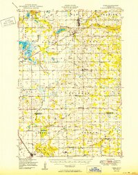
1948 · Pierz
USGS Topo · 1:62,500

1948 · Little Falls
USGS Topo · 1:62,500
1950 · Little Falls
USGS Topo · 1:62,500
1950 · Pierz
USGS Topo · 1:62,500
1950 · St. Cloud
USGS Topo · 1:62,500

1951 · Annandale
USGS Topo · 1:62,500

1953 · Saint Cloud
USGS Topo · 1:250,000

1953 · Stillwater
USGS Topo · 1:250,000

1955 · Stillwater
USGS Topo · 1:250,000

1957 · Saint Cloud
USGS Topo · 1:250,000