
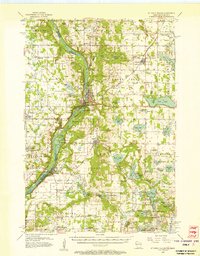
1955 Map of St. Croix Dalles
USGS Topo · Published 1955About this map
St Croix River carves a deep path through this borderland, where the twin settlements of St Croix Falls and Taylors Falls anchor the rugged landscape. The 1955 survey captures the area during the Cold War era, notably featuring the Osceola Air Force Station near the center of the sheet. This period transition is further marked by the presence of Ubet Sch (Abandoned) and El Salem Sch (Abandoned), indicating a shift away from rural one-room schoolhouses toward larger districts.
Find a feature on this map
100 named features on this map. Tap any name to fly to it.
Don’t see what you’re looking for? This feature index may not catch every label — zoom into the map to look around manually.
Map Details
Editions of this 1955 St. Croix Dalles Map
4 editions found
Other maps of this area

1900 · St Croix Dalles
USGS Topo · 1:62,500

1901 · St Croix Dalles
USGS Topo · 1:62,500

1948 · New Richmond
USGS Topo · 1:62,500

1948 · Stillwater
USGS Topo · 1:62,500

1949 · New Richmond
USGS Topo · 1:62,500

1949 · Stillwater
USGS Topo · 1:62,500

1950 · Rush City
USGS Topo · 1:48,000

1950 · Deer Park
USGS Topo · 1:62,500

1950 · Balsam Lake
USGS Topo · 1:62,500

1951 · Milltown
USGS Topo · 1:48,000