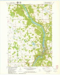
1978 Map of St. Croix Dalles
USGS Topo · Published 1979About this map
The St Croix River serves as the central artery and state boundary in this 1970s survey, separating the steep riverbanks of St Croix Falls in Wisconsin from Taylors Falls in Minnesota. The topography around the St Croix Dalles reveals a landscape shaped by geological forces, where the narrow gorge is flanked by Interstate State Park and St Croix Falls State Park. This era shows the local infrastructure of the upper river valley, including the Powerplant and the Old Railroad Grade passing through the town of Shafer.
Find a feature on this map
47 named features on this map. Tap any name to fly to it.
Don’t see what you’re looking for? This feature index may not catch every label — zoom into the map to look around manually.
Map Details
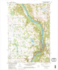
Editions of this 1978 St. Croix Dalles Map
2 editions found
Other maps of this area

1900 · St Croix Dalles
USGS Topo · 1:62,500

1901 · St Croix Dalles
USGS Topo · 1:62,500

1950 · Rush City
USGS Topo · 1:48,000

1951 · Milltown
USGS Topo · 1:48,000

1953 · Stillwater
USGS Topo · 1:250,000

1955 · St. Croix Dalles
USGS Topo · 1:62,500

1955 · Rush City
USGS Topo · 1:62,500

1955 · Milltown
USGS Topo · 1:62,500

1955 · Forest Lake
USGS Topo · 1:62,500

1955 · Stillwater
USGS Topo · 1:250,000