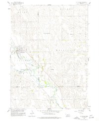
1958 Map of St. Edward
USGS Topo · Published 1977About this map
St Edward serves as the primary hub of this Nebraska landscape, situated at the intersection of a Union Pacific rail line and the winding course of Beaver Creek. The topography is defined by the gradual drainage into the Beaver and Woodville townships, where the Old Indian Boundary cuts diagonally across the section lines of Boone, Platte, and Nance counties. This survey preserves a dense network of early rural education, marking the locations of Mount Pleasant Sch, Big Cut Sch, and Elm Sch, alongside several numbered districts. Outside the town center, the land is marked by small cemeteries like Evergreen Cem and a distinct Spoil Bank near the creek, illustrating the intersection of agricultural land use and mid-century civil engineering.
Find a feature on this map
22 named features on this map. Tap any name to fly to it.
Don’t see what you’re looking for? This feature index may not catch every label — zoom into the map to look around manually.
Map Details
Editions of this 1958 St. Edward Map
3 editions found
Other maps of this area

1896 · Stromsburg
USGS Topo · 1:125,000

1955 · Fremont
USGS Topo · 1:250,000

1957 · Fremont
USGS Topo · 1:250,000

1958 · Fremont
USGS Topo · 1:250,000

1958 · Genoa
USGS Topo · 1:24,000
1958 · Merchiston
USGS Topo · 1:24,000

1958 · Fullerton NE
USGS Topo · 1:24,000

1958 · St. Edward
USGS Topo · 1:24,000

1958 · Albion East
USGS Topo · 1:24,000
1958 · St. Edward SW
USGS Topo · 1:24,000