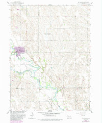
1958 Map of St. Edward
USGS Topo · Published 1985About this map
St Edward sits at the convergence of rail and river in this 1950s survey of the Nebraska plains, later updated to reflect late-century changes. The Union Pacific line parallels the winding path of Beaver Creek, a corridor that historically defined the local economy and transport. To the south, the Old Indian Boundary cuts across the landscape, marking a significant historical line through Boone, Platte, and Nance counties.
Find a feature on this map
13 named features on this map. Tap any name to fly to it.
Don’t see what you’re looking for? This feature index may not catch every label — zoom into the map to look around manually.
Map Details
Editions of this 1958 St. Edward Map
3 editions found
Other maps of this area

1896 · Stromsburg
USGS Topo · 1:125,000

1955 · Fremont
USGS Topo · 1:250,000

1957 · Fremont
USGS Topo · 1:250,000

1958 · Fremont
USGS Topo · 1:250,000

1958 · Genoa
USGS Topo · 1:24,000
1958 · Merchiston
USGS Topo · 1:24,000

1958 · Fullerton NE
USGS Topo · 1:24,000

1958 · St. Edward
USGS Topo · 1:24,000

1958 · Albion East
USGS Topo · 1:24,000
1958 · St. Edward SW
USGS Topo · 1:24,000