Loading...
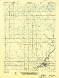
Loading map...1951 Map of St. Francis
USGS Topo · Published 1951About this map
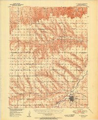
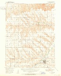
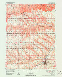
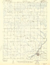
The Republican River and its South Fork Republican River anchor this mid-century survey of Cheyenne County, Kansas. The county seat of St. Francis serves as the focal point, where the Chicago Burlington and Quincy railroad terminates near the Municipal Airport. The surrounding high plains are divided into distinct districts such as Nuttycombe, Eureka, and Cleveland Run, each peppered with the small rural institutions typical of the era's agricultural landscape.
Find a feature on this map
42 named features on this map. Tap any name to fly to it.
Don’t see what you’re looking for? This feature index may not catch every label — zoom into the map to look around manually.
Map Details
Date Portrayed1951
Date Published1951
PublisherU.S. Geological Survey
Map TypeTopographic
Scale1:62,500
Physical Dimensions17 x 20.83 inches
Editions of this 1951 St. Francis Map
3 editions found
Historical Maps of Saint Francis Through Time
4 maps found
Featured Locations
Source Details
SourceU.S. Geological Survey
CopyrightPublic Domain