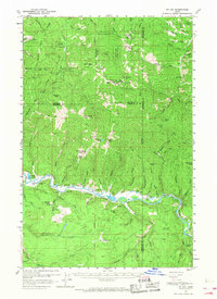
1957 Map of St. Joe
USGS Topo · Published 1968About this map
The St Joe River carves a critical corridor through the mountainous terrain of the Coeur d'Alene National Forest in this mid-century survey. The landscape is defined by its industrial and transport infrastructure, notably the Chicago Milwaukee St Paul and Pacific railroad which follows the river's winding course. This rail line served as a lifeline for small outposts like St Joe and the logging or mining operations at Muellers Camp.
Find a feature on this map
63 named features on this map. Tap any name to fly to it.
Don’t see what you’re looking for? This feature index may not catch every label — zoom into the map to look around manually.
Map Details
Editions of this 1957 St. Joe Map
3 editions found

Other maps of this area

1903 · Rathdrum
USGS Topo · 1:125,000

1909 · Cataldo
USGS Topo · 1:125,000

1911 · Cataldo
USGS Topo · 1:125,000

1950 · Rochat Peak
USGS Topo · 1:24,000

1950 · Twin Crags
USGS Topo · 1:24,000

1952 · Rochat Peak
USGS Topo · 1:24,000

1952 · Twin Crags
USGS Topo · 1:24,000

1955 · Spokane
USGS Topo · 1:250,000

1957 · St. Maries
USGS Topo · 1:62,500

1957 · Kingston
USGS Topo · 1:62,500