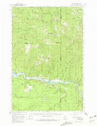
1957 Map of St. Joe
USGS Topo · Published 1981About this map
St Joe River carves a deep winding path through this North Idaho mountain landscape, serving as the primary corridor for transportation and settlement in the late 1950s. The northern banks are defined by the steep slopes of the Coeur d'Alene National Forest, where peaks like Latour Baldy and Boise Peak loom over complex drainage systems including Jackass Creek and Lutour Creek. The industrial footprint of the era is evident at the Palisade Mine and the small outpost of Mineral, while localized activity centers on Muellers Camp and Omega.
Find a feature on this map
69 named features on this map. Tap any name to fly to it.
Don’t see what you’re looking for? This feature index may not catch every label — zoom into the map to look around manually.
Map Details
Editions of this 1957 St. Joe Map
3 editions found

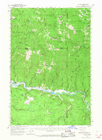
Other maps of this area

1903 · Rathdrum
USGS Topo · 1:125,000

1909 · Cataldo
USGS Topo · 1:125,000

1911 · Cataldo
USGS Topo · 1:125,000

1950 · Rochat Peak
USGS Topo · 1:24,000

1950 · Twin Crags
USGS Topo · 1:24,000

1952 · Rochat Peak
USGS Topo · 1:24,000

1952 · Twin Crags
USGS Topo · 1:24,000

1955 · Spokane
USGS Topo · 1:250,000

1957 · St. Maries
USGS Topo · 1:62,500

1957 · Kingston
USGS Topo · 1:62,500