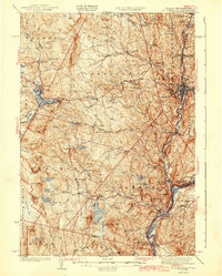
1943 Map of St. Johnsbury
USGS Topo · Published 1943About this map
St Johnsbury serves as the industrial and transportation hub of the northern Connecticut River Valley during the early 1940s. The convergence of the St Johnsbury and Champlain Lake RR, Canadian Pacific RR, and Maine Central RR underscores the importance of this rail corridor in the Northeast Kingdom. The presence of the Frank D Comerford Hydro-Electric Plant along the Connecticut River illustrates the region's transition toward large-scale industrial power generation, while the US Fish Hatchery and local Morses Mills reflect varied federal and local economic interests.
Find a feature on this map
133 named features on this map. Tap any name to fly to it.
Don’t see what you’re looking for? This feature index may not catch every label — zoom into the map to look around manually.
Map Details
Editions of this 1943 St. Johnsbury Map
3 editions found

Other maps of this area

1928 · Hardwick
USGS Topo · 1:62,500

1929 · Moosilauke
USGS Topo · 1:62,500

1931 · Littleton
USGS Topo · 1:62,500

1931 · Woodsville
USGS Topo · 1:48,000

1932 · Littleton
USGS Topo · 1:48,000

1932 · Moosilauke
USGS Topo · 1:62,500

1934 · Hardwick
USGS Topo · 1:48,000

1935 · Woodsville
USGS Topo · 1:62,500

1935 · Littleton
USGS Topo · 1:62,500

1935 · Lyndonville
USGS Topo · 1:48,000