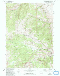
1952 Map of St. Lawrence Basin
USGS Topo · Published 1993About this map
Wind River Indian Reservation lands dominate this high-elevation terrain, where the Missouri River Basin project documented a landscape defined by deep drainages and prominent peaks. The St Lawrence Ranger Station serves as a lone outpost of federal management, situated at the junction of the St Lawrence Ranger Station Road and the St Lawrence Roadless Area. The topography is marked by the massive Sage Creek Basin to the north and the St Lawrence Basin to the south, separated by the high St Lawrence Ridge. Peaks such as Bear Peak and Little Horse Peak overlook a network of seasonal water sources like Wild Horse Spring and the headwaters of the Little Wind River. This 1952 survey provides a clear view of the complex boundary lines and land management divisions within this part of Fremont County.
Find a feature on this map
21 named features on this map. Tap any name to fly to it.
Don’t see what you’re looking for? This feature index may not catch every label — zoom into the map to look around manually.
Map Details
Editions of this 1952 St. Lawrence Basin Map
3 editions found

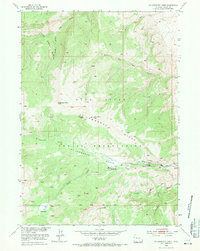
Other maps of this area

1937 · Moccasin Lake
USGS Topo · 1:48,000

1938 · Mt Bonneville
USGS Topo · 1:62,500

1941 · Mt Bonneville
USGS Topo · 1:62,500

1942 · Mt Bonneville
USGS Topo · 1:62,500

1943 · Moccasin Lake
USGS Topo · 1:62,500

1951 · Bull Lake East
USGS Topo · 1:24,000

1952 · Wise Flat
USGS Topo · 1:24,000

1952 · Bull Lake West
USGS Topo · 1:24,000

1952 · Kirkland Park
USGS Topo · 1:24,000

1952 · Paradise Basin
USGS Topo · 1:24,000