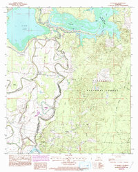
1983 Map of St. Maurice
USGS Topo · Published 1993About this map
St Maurice Plantation and the neighboring community of St Maurice anchor the southern reaches of this landscape where the Red River winds through the borderlands of Winn and Natchitoches Parishes. The area is defined by a complex aquatic network of bayous and brakes, with the sprawling Saline Lake and Black Lake Bayou dominating the northern half. These waterways are managed by infrastructure like Black Lake Dam and Cheechee Dam, reflecting a landscape heavily influenced by drainage and water control. Local social life is centered around rural institutions, including the New Enterprise Sch and several country churches like Harmony Ch and Morning Star Ch. In the east, the terrain transitions into the protected timberlands of the Kisatchie National Forest, while family-named landmarks like Pace Cem and Benjamin Point offer specific points of interest for genealogical research.
Find a feature on this map
41 named features on this map. Tap any name to fly to it.
Don’t see what you’re looking for? This feature index may not catch every label — zoom into the map to look around manually.
Map Details
Editions of this 1983 St. Maurice Map
2 editions found
Other maps of this area

1935 · Verda
USGS Topo · 1:31,680

1937 · Campti NE
USGS Topo · 1:31,680

1937 · Bermuda
USGS Topo · 1:31,680

1937 · Campti SE
USGS Topo · 1:31,680

1937 · Montgomery
USGS Topo · 1:62,500

1942 · Montgomery
USGS Topo · 1:62,500

1943 · Provencal
USGS Topo · 1:62,500

1944 · Campti
USGS Topo · 1:62,500

1945 · Montgomery
USGS Topo · 1:62,500

1945 · Provencal
USGS Topo · 1:62,500