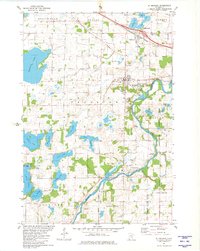
1981 Map of St Michael
USGS Topo · Published 1981About this map
Crow River meanders across the southeastern quadrant of this survey, defining the boundary between Wright Co and Hennepin Co near the settlement of Hanover. The landscape is dominated by a dense concentration of glacial lakes, including the expansive Pelican Lake and smaller bodies such as Beebe Lake, Uhl Lake, and Lake Charlotte. Settlement patterns center on the growing communities of St Michael and Albertville, which are connected by the Burlington Northern railroad corridor. Institutional landmarks like the St Michael-Albertville Sch and St Albert Cem provide key reference points for local history. Evidence of the region's agricultural and industrial roots persists at Berning Mill and various Gravel Pits along the river banks, while the Riverside County Park indicates the early preservation of the riparian corridor.
Find a feature on this map
49 named features on this map. Tap any name to fly to it.
Don’t see what you’re looking for? This feature index may not catch every label — zoom into the map to look around manually.
Map Details
Editions of this 1981 St Michael Map
This is the sole edition of this map. No revisions or reprints were ever made.
Other maps of this area

1909 · Rockford
USGS Topo · 1:62,500

1953 · Stillwater
USGS Topo · 1:250,000

1955 · Stillwater
USGS Topo · 1:250,000

1958 · Stillwater
USGS Topo · 1:250,000

1958 · Rockford
USGS Topo · 1:62,500

1958 · Buffalo
USGS Topo · 1:62,500

1961 · Big Lake
USGS Topo · 1:24,000

1961 · Elk River
USGS Topo · 1:24,000

1961 · Monticello
USGS Topo · 1:24,000

1961 · Monticello
USGS Topo · 1:62,500