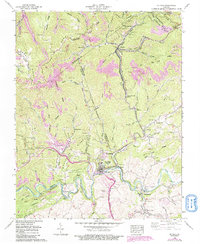
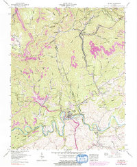
1958 Map of St Paul
USGS Topo · Published 1991About this map
The Clinch River meanders through the southern portion of this region, providing a natural corridor for the Norfolk and Western Ry and the Clinchfield RR. This mid-century survey illustrates a landscape defined by its industrial and transit infrastructure, including the Big Bull Tunnel and Little Bull Tunnel north of Virginia City. The terrain is marked by steep ridges such as Sandy Ridge and Whetsone Ridge, which serve as the backdrop for numerous coal mining operations, evidenced by strip mines and mine dumps clustered near Dante and West Dante.
Find a feature on this map
105 named features on this map. Tap any name to fly to it.
Don’t see what you’re looking for? This feature index may not catch every label — zoom into the map to look around manually.
Map Details
Editions of this 1958 St Paul Map
5 editions found
Other maps of this area

1886 · Grundy
USGS Topo · 1:125,000

1890 · Grundy
USGS Topo · 1:125,000

1892 · Grundy
USGS Topo · 1:125,000

1897 · Bristol
USGS Topo · 1:125,000

1902 · Bristol
USGS Topo · 1:125,000

1913 · Clintwood
USGS Topo · 1:62,500

1914 · Bucu
USGS Topo · 1:48,000

1915 · Clintwood
USGS Topo · 1:62,500

1916 · Bucu
USGS Topo · 1:62,500

1918 · Carterton
USGS Topo · 1:62,500