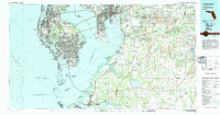
1981 Map of St Petersburg
USGS Topo · Published 1983About this map
St Petersburg and the Interbay Peninsula of Tampa anchor this 1981 survey of the central Florida coast. The map illustrates the region's complex geography of barrier islands, including Treasure Island and St Petersburg Beach, separated from the mainland by Boca Ciega Bay. Industrial and military infrastructure is prominent, with the sprawling Mac Dill Air Force Base situated at the tip of the peninsula and the Sunshine Skyway connecting the Pinellas shore to Manatee County across the mouth of Tampa Bay.
Find a feature on this map
93 named features on this map. Tap any name to fly to it.
Don’t see what you’re looking for? This feature index may not catch every label — zoom into the map to look around manually.
Map Details
Editions of this 1981 St Petersburg Map
This is the sole edition of this map. No revisions or reprints were ever made.
Other maps of this area

1921 · Sand Key
USGS Topo · 1:62,500

1921 · Tampa
USGS Topo · 1:62,500

1921 · Fort De Soto
USGS Topo · 1:62,500

1921 · St Petersburg
USGS Topo · 1:62,500

1942 · Cockroach Bay
USGS Topo · 1:31,680

1943 · St Petersburg
USGS Topo · 1:31,680

1943 · Gandy Bridge
USGS Topo · 1:31,680

1943 · Pass-A-Grille
USGS Topo · 1:31,680

1943 · Bay Pines
USGS Topo · 1:31,680

1943 · Safety Harbor
USGS Topo · 1:31,680