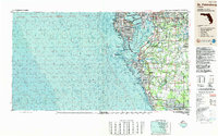
1988 Map of St Petersburg
USGS Topo · Published 1988About this map
St Petersburg and the surrounding Gulf Coast communities appear in late-1980s detail, showing the extensive urban development connecting Clearwater through Largo and Pinellas Park. The map emphasizes the complex maritime geography of the region, from the deep waters of the Egmont Channel to the protected reaches of Old Tampa Bay and Boca Ciega Bay. The presence of MacDill Air Force Base on the Interbay Peninsula highlights the military's significant footprint in the area, while the southern expansion of the region is evident in the growth around Bradenton, Sarasota, and Port Charlotte.
Find a feature on this map
125 named features on this map. Tap any name to fly to it.
Don’t see what you’re looking for? This feature index may not catch every label — zoom into the map to look around manually.
Map Details
Editions of this 1988 St Petersburg Map
This is the sole edition of this map. No revisions or reprints were ever made.
Other maps of this area

1921 · Sand Key
USGS Topo · 1:62,500

1921 · Tampa
USGS Topo · 1:62,500

1921 · Fort De Soto
USGS Topo · 1:62,500

1921 · St Petersburg
USGS Topo · 1:62,500

1942 · Cockroach Bay
USGS Topo · 1:31,680

1943 · St Petersburg
USGS Topo · 1:31,680

1943 · Gandy Bridge
USGS Topo · 1:31,680

1943 · Pass-A-Grille
USGS Topo · 1:31,680

1943 · Bay Pines
USGS Topo · 1:31,680

1943 · Safety Harbor
USGS Topo · 1:31,680