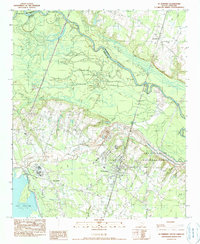
1990 Map of St. Stephen
USGS Topo · Published 1990About this map
St Stephen serves as the primary hub of this Lowcountry landscape, situated where the Atlantic Coast Line railroad intersects the local road network during the late twentieth century. To the west, the industrial and residential footprint of Russellville is clearly defined, bordering the expansive wetlands of Halfway Swamp and Walker Swamp. The northeastern corner is dominated by the Santee River, which forms the winding boundary between Berkeley and Williamsburg Counties.
Find a feature on this map
22 named features on this map. Tap any name to fly to it.
Don’t see what you’re looking for? This feature index may not catch every label — zoom into the map to look around manually.
Map Details
Editions of this 1990 St. Stephen Map
This is the sole edition of this map. No revisions or reprints were ever made.
Other maps of this area

1920 · Chicora
USGS Topo · 1:48,000

1920 · Manning
USGS Topo · 1:48,000

1921 · Chicora
USGS Topo · 1:62,500

1921 · Manning
USGS Topo · 1:62,500

1943 · Chicora
USGS Topo · 1:62,500

1943 · Bonneau
USGS Topo · 1:62,500

1944 · Manning
USGS Topo · 1:62,500

1946 · Kingstree
USGS Topo · 1:62,500

1949 · Georgetown
USGS Topo · 1:250,000

1954 · Augusta
USGS Topo · 1:250,000