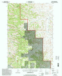
1995 Map of Stacey
USGS Topo · Published 1998About this map
Custer National Forest lands dominate this mid-1990s terrain in Powder River County, where water management is central to the landscape. A network of springs and reservoirs, including Reed Creek Reservoir and Horse Pasture Reservoir, underscores the necessity of livestock watering in this drainage system. The map documents the small settlement at Stacey and the nearby South Stacey School, providing a record of rural social centers that served ranching families in the area. High points like Liscom Butte and its associated Liscom Butte Lookout provided essential fire surveillance over the surrounding creek beds. The presence of Whitetail Cabin and Samuelson Ranch indicates the persisting pattern of seasonal forest use and private landholding within the public forest boundaries, connected by primitive 4WD trails that navigate the draws of Pumpkin Creek.
Find a feature on this map
41 named features on this map. Tap any name to fly to it.
Don’t see what you’re looking for? This feature index may not catch every label — zoom into the map to look around manually.
Map Details
Editions of this 1995 Stacey Map
This is the sole edition of this map. No revisions or reprints were ever made.
Other maps of this area

1954 · Hardin
USGS Topo · 1:250,000

1954 · Ekalaka
USGS Topo · 1:250,000

1956 · Ekalaka
USGS Topo · 1:250,000

1957 · Hardin
USGS Topo · 1:250,000

1958 · Ekalaka
USGS Topo · 1:250,000

1958 · Hardin
USGS Topo · 1:250,000

1965 · Ekalaka
USGS Topo · 1:250,000

1966 · Coleman Draw
USGS Topo · 1:24,000

1966 · Stacey
USGS Topo · 1:24,000

1966 · Home Creek Butte
USGS Topo · 1:24,000