
1974 Map of Stacker Butte
USGS Topo · Published 1977About this map
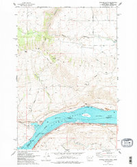
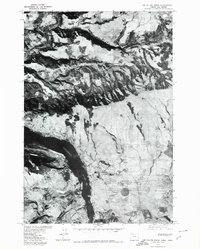
Lake Celilo and the Columbia River dominate the southern landscape of this mid-1970s survey, marking the border between Klickitat County, Washington, and Wasco County, Oregon. The map illustrates the industrial and recreational corridor along the water, featuring the Burlington Northern and Union Pacific railroads on opposing banks. Significant riverside landmarks include Horsethief Lake State Park, the Avery Recreation Area, and navigation markers like the Fivemile Lock Light.
Find a feature on this map
44 named features on this map. Tap any name to fly to it.
Don’t see what you’re looking for? This feature index may not catch every label — zoom into the map to look around manually.
Map Details
Editions of this 1974 Stacker Butte Map
2 editions found
Other maps of this area

1934 · The Dalles
USGS Topo · 1:125,000

1953 · The Dalles
USGS Topo · 1:250,000

1956 · The Dalles
USGS Topo · 1:250,000

1957 · The Dalles
USGS Topo · 1:250,000

1957 · Klickitat
USGS Topo · 1:62,500

1957 · Goldendale
USGS Topo · 1:62,500

1957 · The Dalles
USGS Topo · 1:62,500

1957 · Wishram
USGS Topo · 1:62,500

1974 · The Dalles North
USGS Topo · 1:24,000
1975 · The Dalles North
USGS Topo · 1:24,000