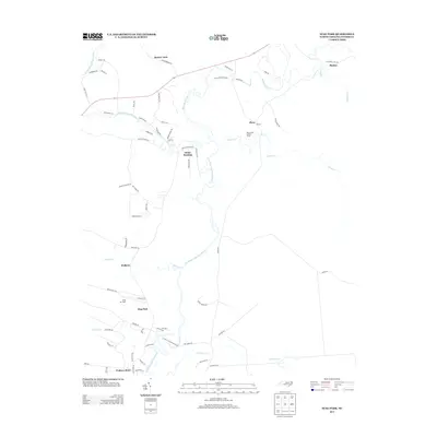
2013 Map of Stag Park
USGS Topo · Published 2013About this map
The Northeast Cape Fear River carves a winding path through this portion of Pender County, defining a landscape of low-lying wetlands and creek systems. Scattered settlements such as White Stocking, Shelter Neck, and Stag Park are connected by a network of rural roads that navigate around significant tributaries like Holly Shelter Cr and Ashes Cr. The presence of Stag Air Park and the Bannerman Lookout Tower indicates a mix of modern utility and traditional forest management in this coastal plain environment. Local commerce and community focal points are preserved in labels like Walkers Store and Walkers, while the northeastern corner shows the transition toward the swampy reaches of Shaken Cr and the settlement of Shaken. The topography is dominated by the river's floodplains, with development largely confined to the slightly higher ground flanking the watercourse.
Find a feature on this map
69 named features on this map. Tap any name to fly to it.
Don’t see what you’re looking for? This feature index may not catch every label — zoom into the map to look around manually.
Map Details
Editions of this 2013 Stag Park Map
This is the sole edition of this map. No revisions or reprints were ever made.
Other maps of this area

1942 · Topsail
USGS Topo · 1:62,500

1942 · Burgaw
USGS Topo · 1:62,500

1947 · Rocky Point
USGS Topo · 1:62,500

1948 · Maple Hill
USGS Topo · 1:62,500

1948 · Topsail
USGS Topo · 1:62,500

1953 · Beaufort
USGS Topo · 1:250,000

1954 · Beaufort
USGS Topo · 1:250,000

1970 · Topsail
USGS Topo · 1:24,000
1970 · Mooretown
USGS Topo · 1:24,000
1970 · Rocky Point
USGS Topo · 1:24,000