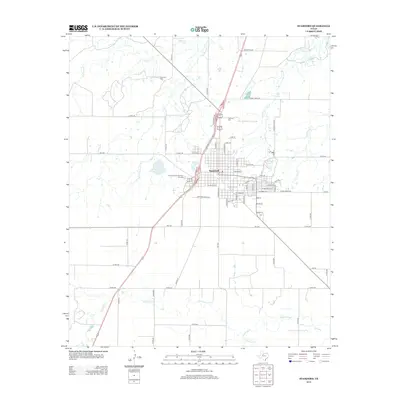
2012 Map of Stamford
USGS Topo · Published 2012About this map
Stamford serves as a prominent hub on the Rolling Plains, shown here during a period of sustained agricultural and cultural identity. The town's layout is centered around the Po and the historic Texas Cowboy Reunion Grounds on the western edge of the settlement, a site that reflects the region's deep ranching heritage. The surrounding landscape is defined by a dendritic network of seasonal waterways, including the curiously named Stink Creek, Turkey Paint Creek, and the southern California Creek. These drainage patterns, alongside man-made features like College Lake and Red Lake, indicate the critical role of water management in this semi-arid environment. Family history and local heritage are anchored at Stamford Cemetery to the north and Highland Cemetery closer to the town center, providing essential points for genealogical research in Jones and Haskell Counties.
Find a feature on this map
64 named features on this map. Tap any name to fly to it.
Don’t see what you’re looking for? This feature index may not catch every label — zoom into the map to look around manually.
Map Details
Editions of this 2012 Stamford Map
This is the sole edition of this map. No revisions or reprints were ever made.
Other maps of this area

1891 · Anson
USGS Topo · 1:125,000

1893 · Anson
USGS Topo · 1:125,000

1954 · Abilene
USGS Topo · 1:250,000

1954 · Wichita Falls
USGS Topo · 1:250,000

1958 · Wichita Falls
USGS Topo · 1:250,000

1958 · Abilene
USGS Topo · 1:250,000

1964 · Sagerton
USGS Topo · 1:24,000

1965 · Tuxedo
USGS Topo · 1:24,000

1965 · Lueders NW
USGS Topo · 1:24,000

1965 · Lueders West
USGS Topo · 1:24,000