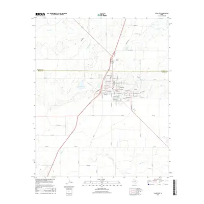
2016 Map of Stamford
USGS Topo · Published 2016About this map
Stamford sits at the intersection of local industry and agriculture, straddling the Haskell Co and Jones Co line. This 2016 survey highlights a town defined by its grid of residential and commercial streets, extending toward College Lake and the smaller Red Lake. The surrounding landscape is etched by a dense network of seasonal and persistent waterways, including the curiously named Stink Cr and several branches of the Paint Creek system, such as Turkey Paint Cr, Red Paint Cr, and Flat Paint Cr.
Find a feature on this map
95 named features on this map. Tap any name to fly to it.
Don’t see what you’re looking for? This feature index may not catch every label — zoom into the map to look around manually.
Map Details
Editions of this 2016 Stamford Map
This is the sole edition of this map. No revisions or reprints were ever made.
Other maps of this area

1891 · Anson
USGS Topo · 1:125,000

1893 · Anson
USGS Topo · 1:125,000

1954 · Abilene
USGS Topo · 1:250,000

1954 · Wichita Falls
USGS Topo · 1:250,000

1958 · Wichita Falls
USGS Topo · 1:250,000

1958 · Abilene
USGS Topo · 1:250,000

1964 · Sagerton
USGS Topo · 1:24,000

1965 · Tuxedo
USGS Topo · 1:24,000

1965 · Lueders NW
USGS Topo · 1:24,000

1965 · Lueders West
USGS Topo · 1:24,000