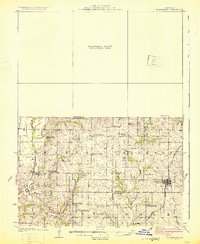
1925 Map of Stanberry
USGS Topo · Published 1925About this map
King City stands as the primary railroad hub in this northwestern Missouri landscape, situated along the tracks of the Chicago Burlington and Quincy. The 1923 survey reveals a rural society organized around an exceptionally dense network of local schools, including Prairie Flower School, Garfield School, and Karr School. These institutions served the farming families settled across the Empire Prairie and the undulating lands divided by the Platte River and its numerous tributaries like Hickory Creek and Island Fork.
Find a feature on this map
30 named features on this map. Tap any name to fly to it.
Don’t see what you’re looking for? This feature index may not catch every label — zoom into the map to look around manually.
Map Details
Editions of this 1925 Stanberry Map
3 editions found
Other maps of this area

1923 · Clarksdale
USGS Topo · 1:62,500

1923 · Maysville
USGS Topo · 1:62,500

1924 · St. Joseph
USGS Topo · 1:62,500

1925 · Clarksdale
USGS Topo · 1:62,500

1925 · Stanberry
USGS Topo · 1:62,500

1925 · Maysville
USGS Topo · 1:62,500

1925 · Darlington
USGS Topo · 1:62,500

1926 · Saint Joseph
USGS Topo · 1:62,500

1927 · Bolckow
USGS Topo · 1:62,500

1939 · Stanberry
USGS Topo · 1:62,500