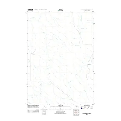
2012 Map of Standing Butte SW
USGS Topo · Published 2012About this map
Rose Ranch, Olson Ranch, and Barrick Ranch anchor this landscape of Stanley County, South Dakota, representing the cattle ranching heritage that remains central to this portion of the state. The terrain is defined by an intricate network of drainages including the Sansarc Cr and its northern fork, which carve through the high plains. The eastern boundary is marked by the split waters of the W Fork Minneconjou Cr and E Fork Minneconjou Cr. This 2012 survey by the U. S. Geological Survey captures the modern state of the range, where gravel routes like Sansarc Rd provide the primary connections between isolated homesteads and the vast open grazing lands of the Missouri River plateau.
Find a feature on this map
8 named features on this map. Tap any name to fly to it.
Don’t see what you’re looking for? This feature index may not catch every label — zoom into the map to look around manually.
Map Details
Editions of this 2012 Standing Butte SW Map
This is the sole edition of this map. No revisions or reprints were ever made.
Other maps of this area

1954 · Pierre
USGS Topo · 1:250,000

1956 · Sansarc NE
USGS Topo · 1:24,000

1956 · Crockett Mountains
USGS Topo · 1:24,000

1958 · Pierre
USGS Topo · 1:250,000

1980 · Princes Ranch
USGS Topo · 1:25,000

1982 · Sansarc
USGS Topo · 1:24,000

1982 · Mission Ridge
USGS Topo · 1:24,000

1983 · Hayes North
USGS Topo · 1:24,000

1983 · Standing Butte
USGS Topo · 1:24,000
1983 · Standing Butte SW
USGS Topo · 1:24,000