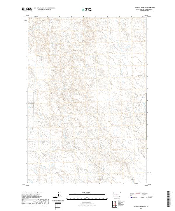
2021 Map of Standing Butte SW
USGS Topo · Published 2021About this map
Sansarc Cr and its northern branch, N Fork Sansarc Cr, define the drainage patterns of this central South Dakota landscape. This 2021 survey by the U.S. Geological Survey captures a sparsely populated region of Stanley County, dominated by the branching headwaters of the Minneconjou Creek system, including both the W Fork Minneconjou Cr and E Fork Minneconjou Cr. The map provides a clear look at the rural road network that facilitates travel through these high plains, anchored by Sansarc Rd. This modern topographical study illustrates the enduring section-line grid of the Public Land Survey System, with township boundaries like t7n r26e providing a framework for land ownership and agricultural use in the twenty-first century.
Find a feature on this map
13 named features on this map. Tap any name to fly to it.
Don’t see what you’re looking for? This feature index may not catch every label — zoom into the map to look around manually.
Map Details
Editions of this 2021 Standing Butte SW Map
This is the sole edition of this map. No revisions or reprints were ever made.
Other maps of this area

1954 · Pierre
USGS Topo · 1:250,000

1956 · Sansarc NE
USGS Topo · 1:24,000

1956 · Crockett Mountains
USGS Topo · 1:24,000

1958 · Pierre
USGS Topo · 1:250,000

1980 · Princes Ranch
USGS Topo · 1:25,000

1982 · Sansarc
USGS Topo · 1:24,000

1982 · Mission Ridge
USGS Topo · 1:24,000

1983 · Hayes North
USGS Topo · 1:24,000

1983 · Standing Butte
USGS Topo · 1:24,000
1983 · Standing Butte SW
USGS Topo · 1:24,000