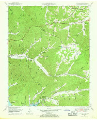
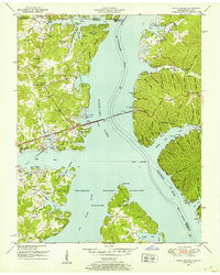
1950 Map of Standing Rock
USGS Topo · Published 1969About this map
The Tennessee River and the waters of Kentucky Lake define the western edge of this 1950 Stewart County landscape. The settlement of Standing Rock serves as a central hub, connected to the surrounding ridges by a network of hollows—such as Lissie Milton Hollow and Opossum Hollow—that reveal a deeply etched topography. The presence of the County farm near Standing Rock Creek and several community institutions, including Fair View Sch and Taylor Chapel, suggests a self-contained rural economy organized around family-named landmarks and small-scale agriculture.
Find a feature on this map
126 named features on this map. Tap any name to fly to it.
Don’t see what you’re looking for? This feature index may not catch every label — zoom into the map to look around manually.
Map Details
Editions of this 1950 Standing Rock Map
4 editions found

Other maps of this area

1936 · Poplar Creek
USGS Topo · 1:24,000

1936 · Tharpe
USGS Topo · 1:24,000

1936 · McKinnon
USGS Topo · 1:24,000

1936 · Hamlin
USGS Topo · 1:24,000

1936 · Stewart
USGS Topo · 1:24,000

1936 · Centerville Landing
USGS Topo · 1:24,000

1936 · Standing Rock
USGS Topo · 1:24,000

1936 · Dover
USGS Topo · 1:24,000
1949 · Poplar Creek
USGS Topo · 1:24,000
1950 · Paris Landing
USGS Topo · 1:24,000