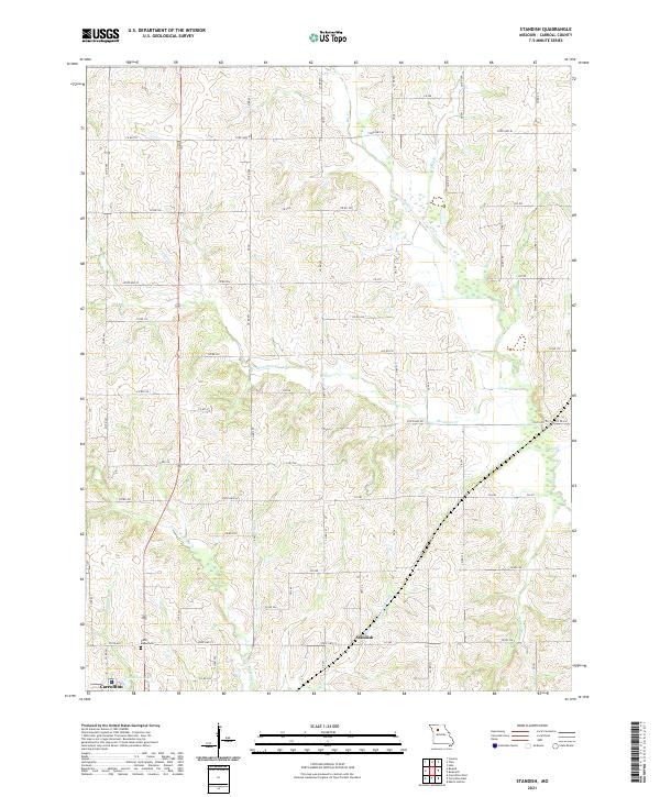
2021 Map of Standish
USGS Topo · Published 2021About this map
Standish sits at the heart of this rural Missouri landscape, where a dense network of county roads and state highways connects scattered farmsteads and agricultural holdings. The terrain is defined by an intricate drainage system that feeds into Little Wakenda Cr and Shootman Cr. To the southwest, the edge of Carrollton enters the frame, marking a transition from the open fields of the countryside to a more concentrated settlement pattern.
Find a feature on this map
67 named features on this map. Tap any name to fly to it.
Don’t see what you’re looking for? This feature index may not catch every label — zoom into the map to look around manually.
Map Details
Editions of this 2021 Standish Map
This is the sole edition of this map. No revisions or reprints were ever made.
Other maps of this area

1889 · Lexington
USGS Topo · 1:125,000

1890 · Marshall
USGS Topo · 1:125,000

1892 · Marshall
USGS Topo · 1:125,000

1901 · Marshall
USGS Topo · 1:125,000

1924 · Dawn
USGS Topo · 1:62,500

1924 · Hale
USGS Topo · 1:62,500

1950 · Coloma
USGS Topo · 1:24,000

1950 · Hale
USGS Topo · 1:24,000

1951 · Hale
USGS Topo · 1:24,000

1951 · Bosworth
USGS Topo · 1:24,000