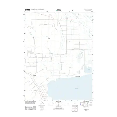
2012 Map of Standish
USGS Topo · Published 2012About this map
Honey Lake dominates the southern reaches of this Lassen County landscape, where the high desert terrain meets a complex system of sloughs and irrigation. The settlements of Standish, Edgemont, and Buntingville are connected by a network of rural roads and canals, reflecting the area's agricultural reliance on water management. Features like the Main Canal and Lower Canal distribute water across the flats toward Dill Slough and Fish Slough, while the Hartson Sand Ridge provides a distinct topographic break near Hartson Lake. To the west, the elevation rises toward Bald Mountain and Byers Pass, where Bald Mountain Spring and Charlie Spring offer natural water sources above the valley floor. This survey documents the persistent human efforts to utilize the arid Honey Lake Valley through hydraulic engineering and established ranching corridors.
Find a feature on this map
64 named features on this map. Tap any name to fly to it.
Don’t see what you’re looking for? This feature index may not catch every label — zoom into the map to look around manually.
Map Details
Editions of this 2012 Standish Map
This is the sole edition of this map. No revisions or reprints were ever made.
Other maps of this area

1886 · Honey Lake
USGS Topo · 1:250,000

1891 · Honey Lake
USGS Topo · 1:250,000

1893 · Honey Lake
USGS Topo · 1:250,000

1950 · Kettle Rock
USGS Topo · 1:62,500

1950 · Milford
USGS Topo · 1:62,500

1954 · Susanville
USGS Topo · 1:62,500

1954 · Litchfield
USGS Topo · 1:62,500

1955 · Westwood
USGS Topo · 1:250,000

1958 · Westwood
USGS Topo · 1:250,000

1959 · Westwood
USGS Topo · 1:250,000