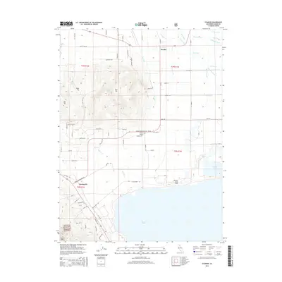
2015 Map of Standish
USGS Topo · Published 2015About this map
The Honey Lake Valley is defined by an intricate network of irrigation and drainage infrastructure designed to manage the high-desert landscape of Lassen County. Central to this system are the Main Canal, Lower Canal, and Woodstock Canal, which redirect water across the flats toward the expansive shoreline of Honey Lake. The settlements of Standish and Buntingville serve as local hubs for the surrounding ranching and agricultural tracts, which are partitioned by a dense grid of named rural roads like Mapes Rd and Standish Buntingville Rd. To the west, the terrain rises sharply from the valley floor into the heights of Bald Mtn and Bass Hill, where landmarks like Bald Mountain Spring and Byers Pass mark the transition into the Plumas National Forest. Along the eastern edge, the Susan River feeds into a series of sloughs, including Fish Slough and Dill Slough, creating a complex riparian environment near Hartson Lake.
Find a feature on this map
78 named features on this map. Tap any name to fly to it.
Don’t see what you’re looking for? This feature index may not catch every label — zoom into the map to look around manually.
Map Details
Editions of this 2015 Standish Map
This is the sole edition of this map. No revisions or reprints were ever made.
Other maps of this area

1886 · Honey Lake
USGS Topo · 1:250,000

1891 · Honey Lake
USGS Topo · 1:250,000

1893 · Honey Lake
USGS Topo · 1:250,000

1950 · Kettle Rock
USGS Topo · 1:62,500

1950 · Milford
USGS Topo · 1:62,500

1954 · Susanville
USGS Topo · 1:62,500

1954 · Litchfield
USGS Topo · 1:62,500

1955 · Westwood
USGS Topo · 1:250,000

1958 · Westwood
USGS Topo · 1:250,000

1959 · Westwood
USGS Topo · 1:250,000