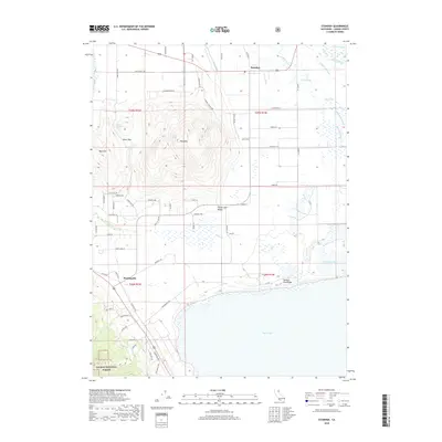
2018 Map of Standish
USGS Topo · Published 2018About this map
Honey Lake Valley defines this portion of Lassen County, where the sprawling expanse of Honey Lake dominates the southern landscape. The settlement of Standish serves as a local hub near the northern margin, situated amidst an intricate network of irrigation features such as the Main Canal and Lower Canal that support the region's agricultural character. To the west, the terrain rises sharply from the valley floor toward Bald Mtn, where Charlie Spring and Bald Mountain Spring provide essential water sources in the higher elevations.
Find a feature on this map
73 named features on this map. Tap any name to fly to it.
Don’t see what you’re looking for? This feature index may not catch every label — zoom into the map to look around manually.
Map Details
Editions of this 2018 Standish Map
This is the sole edition of this map. No revisions or reprints were ever made.
Other maps of this area

1886 · Honey Lake
USGS Topo · 1:250,000

1891 · Honey Lake
USGS Topo · 1:250,000

1893 · Honey Lake
USGS Topo · 1:250,000

1950 · Kettle Rock
USGS Topo · 1:62,500

1950 · Milford
USGS Topo · 1:62,500

1954 · Susanville
USGS Topo · 1:62,500

1954 · Litchfield
USGS Topo · 1:62,500

1955 · Westwood
USGS Topo · 1:250,000

1958 · Westwood
USGS Topo · 1:250,000

1959 · Westwood
USGS Topo · 1:250,000