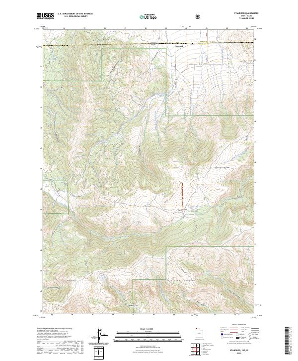
2023 Map of Standrod
USGS Topo · Published 2023About this map
The settlement of Standrod sits precisely on the border of Utah and Idaho, where the high country of the Bally Mountains transitions into the steep drainages of the northern Raft River Mountains. This landscape is defined by its intricate hydrological network, with numerous springs such as Dipping Vat Spring and Oliver Spring feeding into creeks that carve through the local terrain. The southern portion of the sheet is dominated by the Sawtooth National Forest, containing high-elevation landmarks like George Peak and the alpine waters of Fisher Lake.
Find a feature on this map
38 named features on this map. Tap any name to fly to it.
Don’t see what you’re looking for? This feature index may not catch every label — zoom into the map to look around manually.
Map Details
Editions of this 2023 Standrod Map
This is the sole edition of this map. No revisions or reprints were ever made.
Other maps of this area

1954 · Pocatello
USGS Topo · 1:250,000

1954 · Brigham City
USGS Topo · 1:250,000

1958 · Pocatello
USGS Topo · 1:250,000

1958 · Brigham City
USGS Topo · 1:250,000

1959 · Park Valley
USGS Topo · 1:62,500

1959 · Yost
USGS Topo · 1:62,500

1962 · Brigham City
USGS Topo · 1:250,000

1968 · Jim Sage Canyon
USGS Topo · 1:24,000

1968 · Naf
USGS Topo · 1:24,000

1968 · Chokecherry Canyon
USGS Topo · 1:24,000